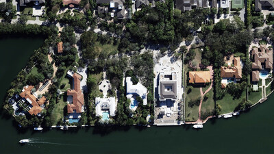
Both researchers and NOAA predict an above-normal hurricane season for 2024, and Windward is getting ready to respond faster and more effectively at scale with high-resolution aerial imagery and accurate damage assessments.
Vexcel deploys its fleet of fixed-wing aircraft equipped with photogrammetric sensors to collect post-disaster imagery (called Gray Sky) of impacted areas after hurricanes, tornadoes, and wildfires. Vexcel rapidly processes and publishes the detailed imagery to help insurers, government agencies, and others understand the full scope of the disaster. In addition, by using the latest in AI and machine learning, Vexcel provides a damage assessment of every property in the Gray Sky collection area that includes an overall CAT score, roof damage score, and more.
Windward Risk Managers will use this detailed aerial imagery and property-level damage assessments for its future hurricane claims response to better manage resources, understand exactly which customers have been impacted and at what level, and more accurately estimate the overall loss. By streamlining claims operations and prioritizing resources, Windward can accelerate claims closure, enabling policyholders to begin the rebuilding process sooner.
"In addition to better managing resources and more accurately estimating the ultimate loss, we look forward to being more proactive in serving our customers who experience hurricane damage now that we have Vexcel," said Mike Williams, Senior VP of Claims and Litigation at Windward Risk Managers.
Committed to Collecting Aerial Imagery in Florida
Vexcel has collected high-resolution imagery in Florida since 2017, covering both urban and rural areas across all 67 counties. The company frequently updates its Florida imagery library and refreshes urban and metro areas up to three times per year. Vexcel has also collected imagery of hurricane damaged properties over the past seven years, including Hurricanes Idalia, Ian, Michael, and Irma. Vexcel's ongoing commitment to Florida, combined with its extensive archive of past imagery, ensures that Windward will benefit from the most comprehensive and up-to-date data available.
"Our commitment to capturing and delivering timely, accurate data will help Windward Risk Managers respond more effectively to natural disasters, ensuring that policyholders receive the support they need when they need it most," said Glen Brooks, SVP, Insurance at Vexcel.
About Windward Risk Managers
Headquartered in Boca Raton, Florida, Windward Risk Managers has helped each of its carriers maintain a Financial Stability Rating of A-Exceptional from Demotech by adhering to disciplined and conservative underwriting principles and conservative reinsurance protection, while offering policyholders an exceptional customer experience, competitive rates and customizable policy options.
Since 2005, the combined portfolio of Florida Peninsula, Edison, and Ovation Home Insurance Exchange has grown to be one of the largest in Florida with total written premiums exceeding $1.1B and over 275,000 policyholders.
About Vexcel
For over 30 years, Vexcel has been the industry leader in the photogrammetric and remote sensing space, building market-leading UltraCam sensors, and providing a comprehensive library of cloud-based geospatial data. The Vexcel Data Program is the largest aerial imagery program in the world, collecting high-resolution imagery and geospatial data in 40+ countries. Its dedicated fleet of fixed-wing aircraft capture imagery in the U.S., UK, Canada, Australia, New Zealand, Japan, and across Western Europe. Vexcel's unique technology stack results in consistency across its aerial collection programs. Its comprehensive aerial data library helps customers streamline remote assessment, innovate common workflows, and enhance decision-making with confidence. In addition, Vexcel is the operations partner for the Geospatial Insurance Consortium. More at: vexceldata.com
![]() View original content to download multimedia:
https://www.prnewswire.com/news-releases/windward-risk-managers-enhances-claims-operations-with-vexcels-aerial-imagery-and-damage-assessments-302242729.html
View original content to download multimedia:
https://www.prnewswire.com/news-releases/windward-risk-managers-enhances-claims-operations-with-vexcels-aerial-imagery-and-damage-assessments-302242729.html
SOURCE Vexcel Data Program
| Contact: |
| Company Name: Vexcel Data Program
Kris Wagner, Marketing Director Email Contact |


