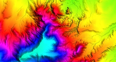
Led by the USGS National Geospatial Program, 3DEP offers the nation's first baseline of seamless, high-resolution topographic elevation data, which is then incorporated into The National Map. These data are free and publicly available to local, state, and national agencies. They are used to inform decisions that impact the immediate safety of life, property, and the environment, and they are critical to effective, long-term infrastructure planning.
In Arkansas, lidar data has proved beneficial in supporting numerous business activities, including agriculture and precision farming, and has advanced flood-risk management, urban and regional planning, natural resources conservation, and critical mineral assessment.
Under this task order, Woolpert will collect 24,533 square miles of aerial lidar data, including parts of the Ozark-St. Francis and Ouachita National forests, using a Leica TerrainMapper. Woolpert Project Manager Megan Blaskovich said that the size and complexity of the area of interest required extensive planning. She expects the lidar data to be acquired by fall 2024 and delivered in summer 2025. QL1 data are collected at 8 points per square meter.
"This is one of the largest Quality Level 1 lidar acquisition projects our team has been tasked with. We will be flying 996 flight lines and collecting over 940 ground control survey points," Blaskovich said. "We are excited to get started."
Woolpert has supported 3DEP since its launch nearly a decade ago. The firm has collected data across multiple states, tested sensors for optimal acquisition, and provided training for state and local government officials. Most recently, Woolpert delivered 13,000 square miles of aerial lidar data collected across southwest Ohio and completed lidar data acquisition across Colorado and Oregon under additional task orders for the USGS.
"It has been an honor supporting the U.S. Geological Survey and its efforts updating and enhancing The National Map," Woolpert Program Director John Gerhard said. "The importance of this work extends far beyond the project's completion. From disaster preparedness and emergency response to long-term infrastructure planning, these data will help inform decisions to improve the lives of individuals for years to come."
About Woolpert
Woolpert is the premier architecture, engineering, geospatial (AEG), and strategic consulting firm, with a vision to become one of the best companies in the world. We innovate within and across markets to effectively serve public, private, and government clients worldwide. Woolpert is a Global Top 100 Geospatial Company, a Top 100 ENR Global Design firm, has earned seven Great Place to Work certifications, and actively nurtures a culture of growth, inclusion, diversity, and respect. Founded in 1911 in Dayton, Ohio, Woolpert has been America's fastest-growing AEG firm since 2015. Woolpert has over 2,000 employees and more than 60 offices on five continents. For more, visit
woolpert.com.
Media contact: Jill Kelley; 937-531-1258, Email Contact
![]() View original content to download multimedia:
https://www.prnewswire.com/news-releases/woolpert-contracted-by-usgs-to-collect-aerial-lidar-data-across-eastern-arkansas-for-3dep-301983411.html
View original content to download multimedia:
https://www.prnewswire.com/news-releases/woolpert-contracted-by-usgs-to-collect-aerial-lidar-data-across-eastern-arkansas-for-3dep-301983411.html
SOURCE Woolpert
| Contact: |
| Company Name: Woolpert
|


