With Nearmap’s clear, current aerial captures, Auric reduces change orders, improves its qualification process and drafts winning proposals
SOUTH JORDAN, Utah — (BUSINESS WIRE) — December 4, 2018 — Auric Solar, a residential and commercial solar power provider, has turned to Nearmap, a premium global location content provider specializing in high-resolution, aerial maps, to accelerate the company’s initial assessments, have a more complete and accurate view of properties, and create winning proposals.
This press release features multimedia. View the full release here: https://www.businesswire.com/news/home/20181204005667/en/

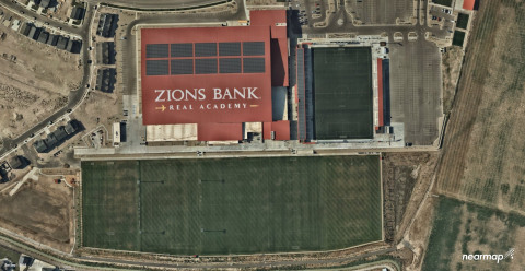
Nearmap’s high-resolution captures combined with Aurora’s responsive engineering interface deliver a combination of 3-D lidar models and 2-D high-resolution maps for complete accuracy in the planning and measuring stage of a project. (Photo: Business Wire)
Auric accesses Nearmap imagery through the Aurora Solar platform, a solar sales and design software program. By utilizing Aurora software integrated with Nearmap imagery, Auric analysts have access to crystal clear and current imagery.
“Aurora’s responsive engineering interface coupled with Nearmap’s high-resolution captures allow us to use a combination of 3-D lidar models and 2-D high-resolution maps for complete accuracy in the planning and measuring stage of a project. This equips both the sales and analytics teams with accurate information to save time, money and serve the customer,” said Tyler Soukup, Director of Analytics at Auric Solar.
Analysts can make accurate measurements, run production numbers, identify roof obstructions and craft proposals all within the program. The sales team, analysts and installers are all on the same page—significantly reducing change orders.
Auric also has access to Nearmap historical imagery from years past, including leaf-on and leaf-off imagery—the presence or lack of the foliage depending on the season. This greatly enhances shading analysis, making it easier to place the panels for maximum sun exposure.
The company not only saves a significant amount of time with less onsite visits to qualify homes, but it also opens up more customers to solar.
“We’ve been able to qualify more customers than ever because of Nearmap’s clear, current captures. You really can't accurately qualify a property without up-to-date imagery,” notes Soukup.
With annotated, high-resolution imagery incorporated into proposals, customers are impressed and have a clear understanding of the project.
“We quote projects from $20,000 to a few million dollars, and our proposals, plans and marketing materials should match that level of value,” said Soukup. “Nearmap helps us achieve that. It creates a ‘wow’ factor.”
Before using Nearmap aerial imagery, Auric resorted to using low-resolution satellite imagery to qualify properties. With outdated, blurry imagery, it was difficult to make accurate measurements and qualify a home before sending a technician for an on-site assessment.
Auric Solar is one of the fastest growing companies in the nation, with recognition on three consecutive Inc. 5000 lists and offices in Colorado, Idaho, Oregon and Utah.
About Nearmap
Nearmap brings the real world to you. Nearmap delivers high-resolution aerial imagery as a service to businesses across the world, powered by industry-leading geospatial mapping technology. Using its own patented camera systems and processing software, Nearmap captures wide-scale urban areas in the U.S., Australia and New Zealand multiple times each year, making fresh content instantly available in the cloud via web app or API integration.
Every day, Nearmap helps thousands of users conduct virtual site visits for deep, data-driven insights—enabling informed decisions, streamlined operations and robust bottom lines.
Founded in Australia in 2007, Nearmap is one of the ten largest aerial survey companies in the world by annual data collection volume and is publicly listed in the ASX 300.
View a current project in Nearmap today. For more information, visit https://go.nearmap.com.
View source version on businesswire.com: https://www.businesswire.com/news/home/20181204005667/en/
Contact:
PR Contact:
SnappConner PR
Mark Fredrickson,
801-806-0161
Email Contact


